A historic Nova Scotia community poised for transformation —
nestled between Lake MicMac and Lake Charles in Dartmouth.
Where Is Port Wallace?
Port Wallace sits on the northeastern edge of Dartmouth, within the Halifax Regional Municipality (HRM), Nova Scotia. The community occupies roughly 545 acres (220 hectares) of land between two significant bodies of water: Lake MicMac to the southwest and Lake Charles to the northeast. Waverley Road (Route 318) runs through its centre, connecting the area to both Dartmouth and the communities further north along the corridor.
Highway 107 forms a natural boundary to the north and northeast, while the existing neighbourhoods of Montebello and Keystone Village sit along Waverley Road to the south and east. The area is directly adjacent to Shubie Park, one of HRM's most popular green spaces, and the historic Shubenacadie Canal system. Its coordinates are approximately 44.69889°N, 63.54778°W, and it falls within postal codes B2W and B2X.
A History Rooted in Water and Industry
The area now known as Port Wallace has deep historical roots. The Mi'kmaq people used Lake MicMac and the surrounding waterways for centuries as part of their travel and trade routes long before European settlement. The lake's name itself derives from the Mi'kmaq heritage of this region.
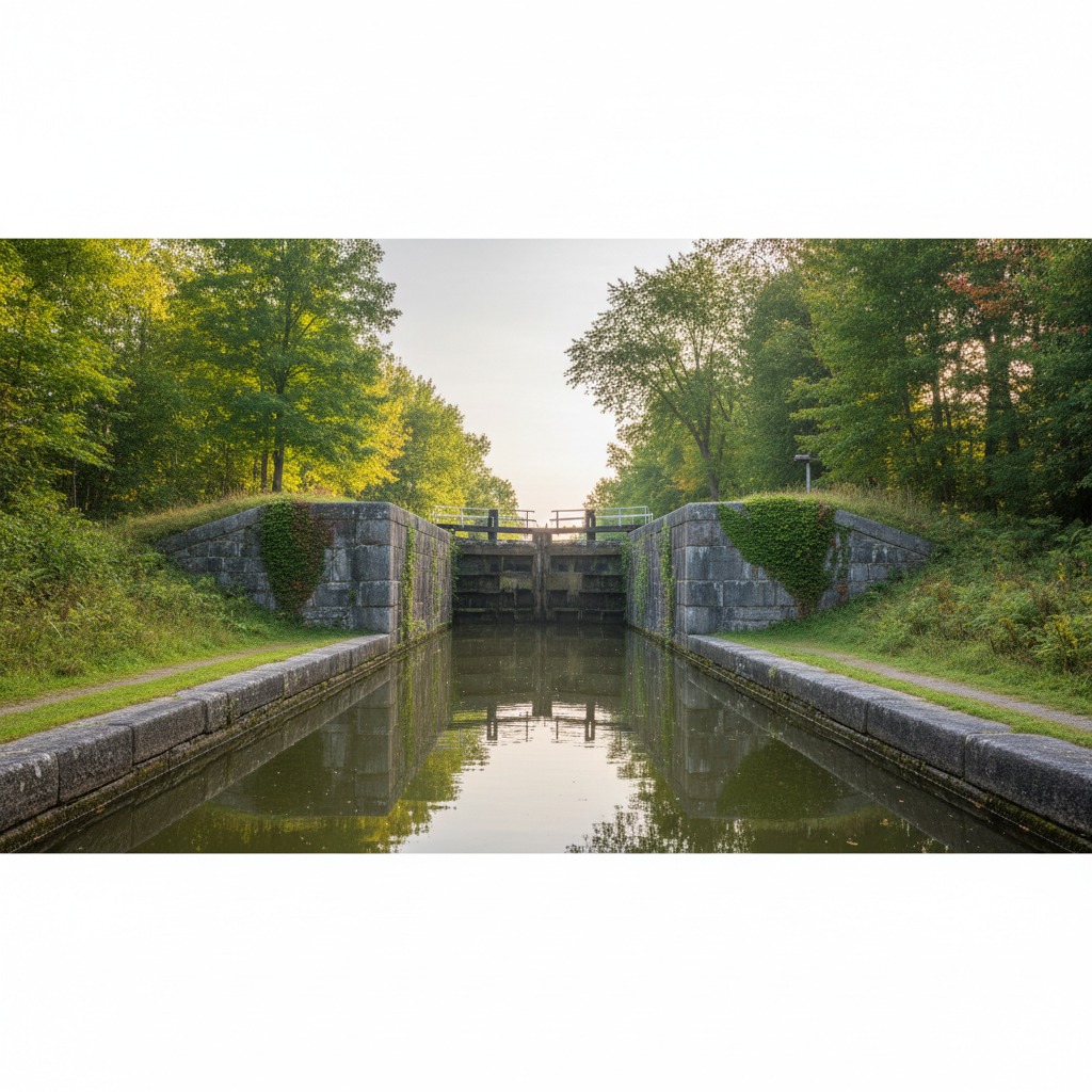
The community was formally established in 1861 and named for Michael Wallace, a prominent colonial administrator who served as president of the Shubenacadie Canal Company. Between 1826 and 1831, canal workers lived in the area while constructing sections of the Shubenacadie Canal, one of the earliest canal projects in North America, designed to connect Halifax Harbour to the Bay of Fundy via a chain of lakes and rivers.
For years, the community was commonly known as "Port Wallis" — a spelling variation that persisted until 1963, when the name was officially corrected to Port Wallace to accurately honour its namesake.
Why Port Wallace Matters Now
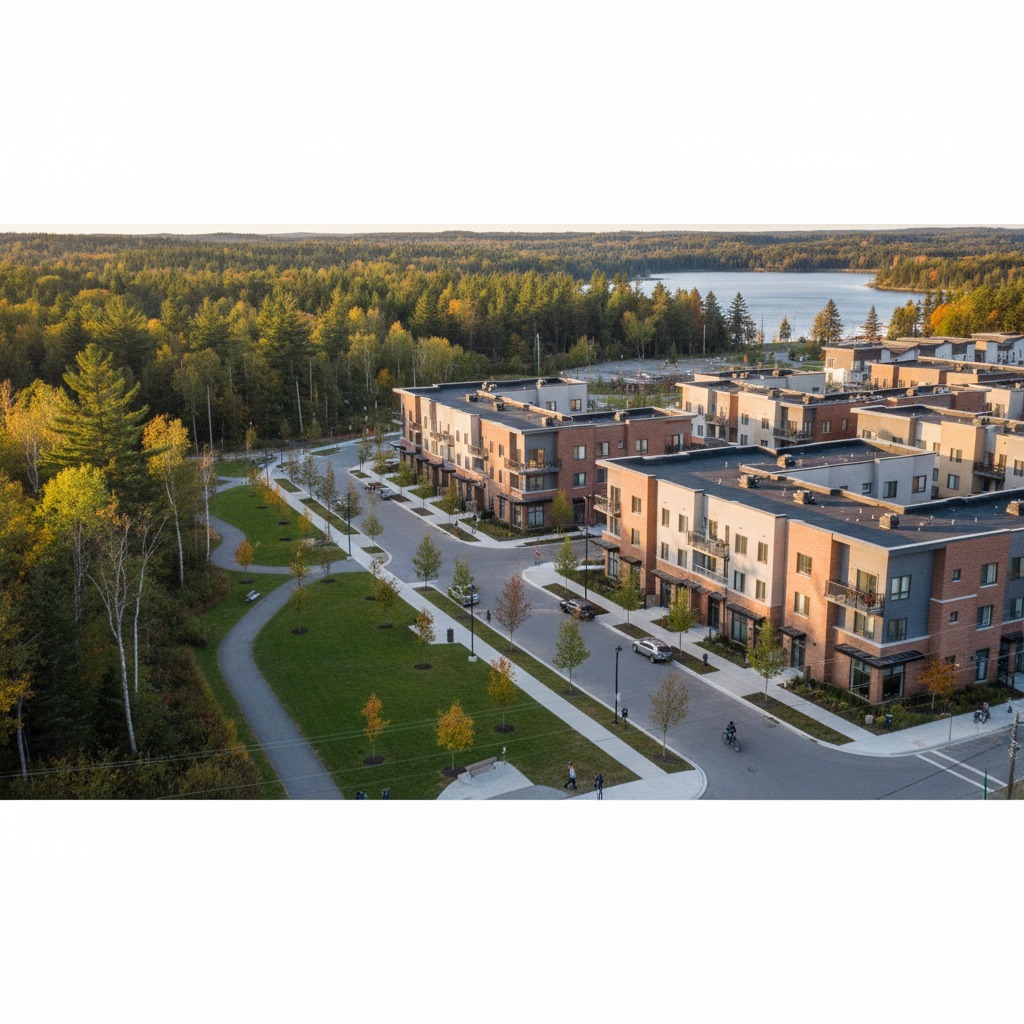
Port Wallace has been designated as a Special Planning Area (SPA) by the Province of Nova Scotia, making it one of the most significant development projects in the Halifax region. Driven by intense housing demand across the municipality, plans call for up to 4,900 residential units to be built across the 545-acre site.
The development is being planned as a complete community — not just a bedroom suburb. Plans include mixed housing types, commercial space, schools, parks, and transit connections. It represents Halifax's response to rapid population growth and the need for well-planned new neighbourhoods that balance density with livability.

What Makes Port Wallace Unique
Unlike many suburban developments, Port Wallace benefits from an exceptional natural setting. The community is framed by two lakes, bordered by Shubie Park's 40 hectares of trails and green space, and threaded with the heritage of the Shubenacadie Canal. Few new developments anywhere in Atlantic Canada can offer this combination of waterfront proximity, mature parkland, and historical significance.
The plan envisions Port Wallace as a designed community from the ground up — with connected streets, walkable neighbourhoods, protected natural corridors, and a mix of housing options from single-family homes to multi-unit buildings. Rather than piecemeal sprawl, this is intended to be a place with a centre, an identity, and a sense of belonging.
Municipal District & Governance
District 6 — Harbourview-Burnside-Dartmouth East
Port Wallace falls within District 6 of the Halifax Regional Municipality. This district, known as Harbourview-Burnside-Dartmouth East, is represented by a councillor on Halifax Regional Council. The district encompasses several communities in northeastern Dartmouth, including the Burnside Industrial Park area and established residential neighbourhoods.
For community-level planning matters, Port Wallace is governed through the Harbour East-Marine Drive Community Council, one of HRM's community councils responsible for local land-use planning and development decisions.
Key Administrative Details
- Municipality: Halifax Regional Municipality (HRM)
- Province: Nova Scotia, Canada
- District: 6 — Harbourview-Burnside-Dartmouth East
- Community Council: Harbour East-Marine Drive
- Postal Codes: B2W, B2X
- Planning Designation: Special Planning Area (SPA)
- Area: ~545 acres (220 hectares)
Explore More
Dive deeper into the topics that matter most as Port Wallace takes shape.